T-Fence Polygon Plotter
Fence Polygon Plotter is a tiny browser tool for laying out odd-shaped fence lines from survey-style bearings and distances.
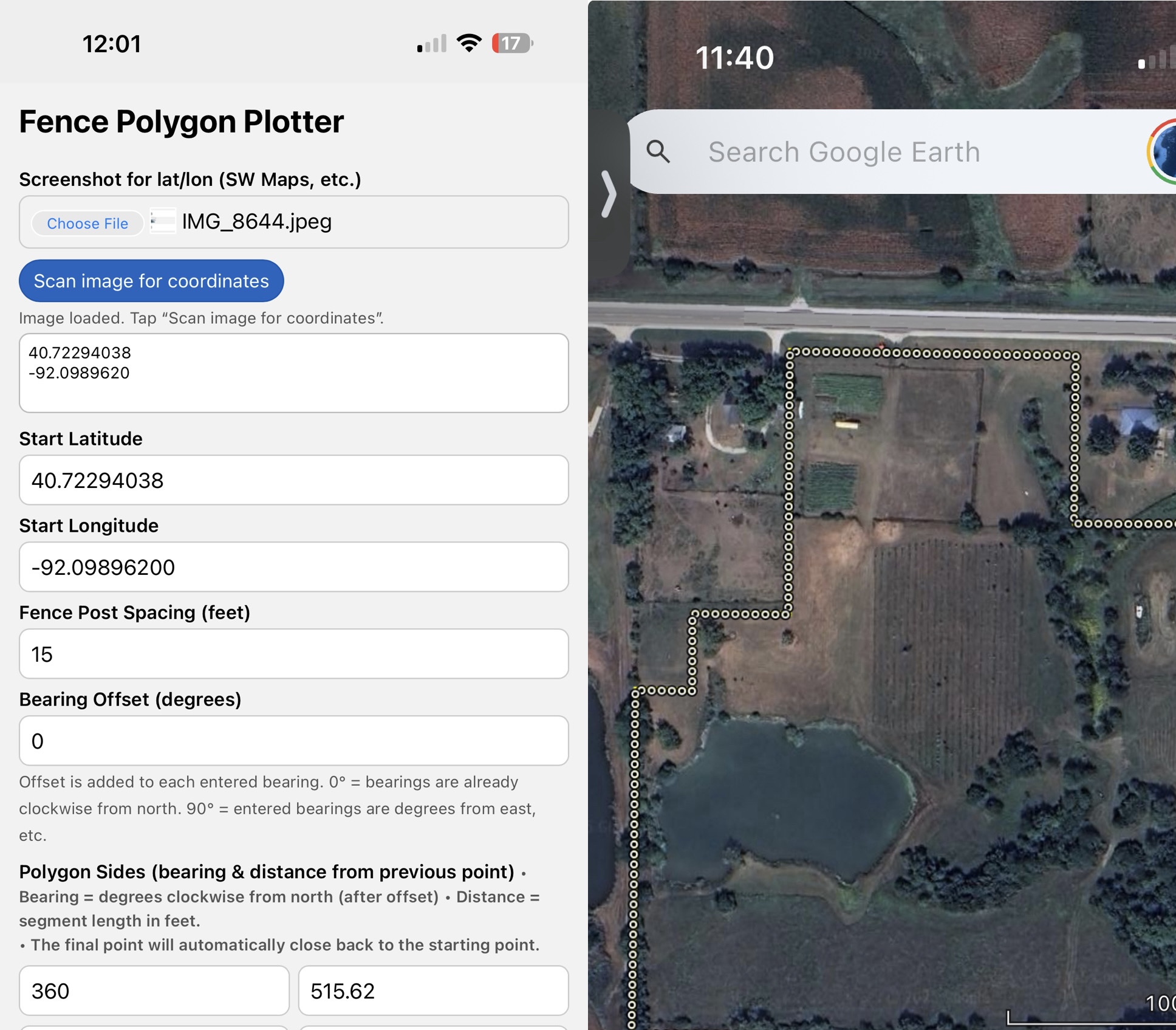
Enter a starting latitude/longitude, then type each side of your fence as bearing + distance in feet. The app:
- Calculates each corner from your bearings
- Automatically closes the last leg back to the starting point
- Lays out fence posts along the perimeter at whatever spacing you choose
- Shows a simple preview sketch of the polygon and post locations
- Exports a KML file you can open in SW Maps, Google Earth, or other GIS apps
Features
- Up to 20 sides (segments) per polygon
- Bearing offset option (use 0° for “clockwise from north”, 90° for “degrees from east”, etc.)
- Bright yellow fence line, with small white post dots that show up clearly on satellite imagery
- Automatic closure check with a reported closure error in feet
- “Clear All” button to wipe everything and start a new layout
- Runs completely in your browser – no login, no server, no internet required after loading
This is mainly aimed at:
- Farmers & landowners laying out new fence lines
- People converting metes-and-bounds / legal descriptions into something visual
- RTK / GPS users who want a quick way to turn bearings into a KML overlay
Feedback, ideas, and bug reports are very welcome – this is an evolving little field tool.
Leave a comment
Log in with itch.io to leave a comment.