G2 Horizon Triangulation Bearing Surveyor
G2 Horizon Triangulation Bearing Surveyor
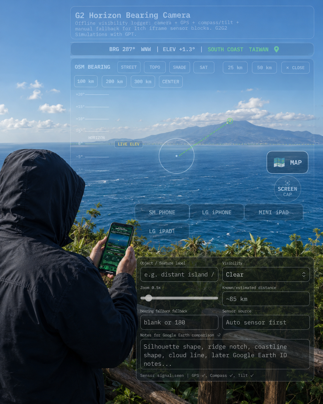
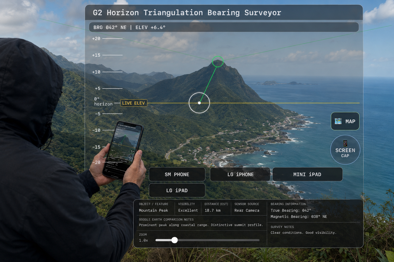
A field tool for identifying distant mountains, islands, ridges, towers, coastlines, and other horizon features using your phone's camera and sensors.
FEATURES
• Live camera view
• GPS location display
• Digital compass bearing
• Elevation angle indicator
• Live horizon line overlay
• Zoom support
• Bearing capture screenshots
• OpenStreetMap integration
• Topographic map layer
• Street map layer
• Hillshade terrain layer
• Satellite imagery layer
• 25 km map range
• 50 km map range
• 100 km map range
• 200 km map range
• 300 km map range
• GPS accuracy circle
• Bearing projection line
• Manual bearing mode
• Automatic compass mode
• Two-point triangulation system
• Mark Point A
• Mark Point B
• Target intersection calculation
• Estimated target coordinates
• Distance calculations
• Mobile phone support
• iPhone support
• Android support
• iPad Mini support
• Full-size iPad support
• Offline-friendly operation
TRIANGULATION MODE
Aim at the same distant mountain, island, ridge, or structure from two different locations.
Mark Point A.
Move to a second location and mark Point B.
Press TRIANGULATE.
The app calculates where the two bearing lines intersect and places an estimated target marker on the map.
Useful for:
• Mountain identification
• Island identification
• Horizon mapping
• Peak spotting
• Coastal observation
• Navigation study
• Surveying demonstrations
• Geography education
IMPORTANT
This software is intended for educational and observational use only.
Not intended for navigation, aviation, marine navigation, emergency response, surveying, or life-safety applications.
Created by G2G2 Simulations with ChatGPT.
Leave a comment
Log in with itch.io to leave a comment.