G2G2 Horizon Bearing Camera Pro
G2G2 Horizon Bearing Camera
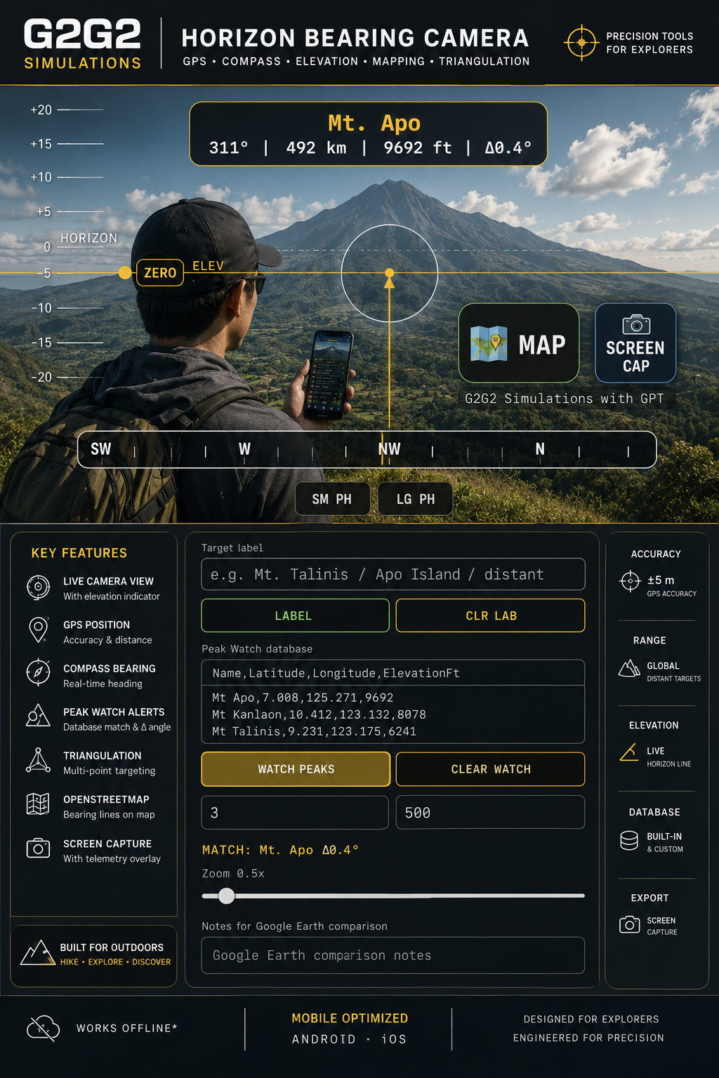
A field observation and bearing-mapping tool combining:
• Live camera view
• GPS position
• Compass bearing
• Elevation indicator
• Horizon calibration
• OpenStreetMap bearing line
• Triangulation system
• Peak Watch target alerts
• Screen capture with telemetry overlay
Useful for identifying mountains, islands, ridges, landmarks, towers, and distant features.
Includes a built-in Philippines target database containing mountains, volcanoes, islands, dive sites, and reference landmarks.
NOT FOR:
Navigation
Aviation
Marine navigation
Rescue operations
Legal surveying
A G2G2 Simulations Analysis with GPT
Leave a comment
Log in with itch.io to leave a comment.